Our Favorite Overnight Hikes in the White Mountains: Part 1
The White Mountain National Forest encompasses almost 800,000 acres of land in New Hampshire and Maine. Within those almost 1 million acres of land are over 650 individually named trails that are just waiting to be explored by the outdoor enthusiast. This week, we are sharing some of our favorite overnight routes within the White Mountains of New Hampshire. These routes will range in difficulty from easy to hard. We will rank each route in three categories: navigation, elevation per mile, and logistics. Each hike will earn a score between 1 and 10, one being easiest and ten being hardest, in each category. Navigation encompasses the difficulty to navigate the trail and the skills needed to follow the trail. Elevation per mile is how steep the trail is overall and the physical difficulty of the hike for the average hiker. Logistics includes whether or not the hike requires booking things ahead of time or if it would require a carspot for a solo hiker.
Furthermore, we will give general information about each route including miles, overall elevation gain, and a summary of the terrain you will encounter, as well as camping options. We encourage everyone who sets out on a hike in the White Mountains of New Hampshire to purchase a copy of the White Mountain Guide and map set and study the route before setting out. Follow Leave No Trace Principles, camp only in designated spots, and bring the Ten Essentials (at minimum). Let someone at home know your planned itinerary and check the weather at the trailhead as well as on the summit (when applicable) the day you intend on setting out.
Route One
Isolation Loop
Total Miles: 23
Elevation Gain: 6,400’
Navigation: 4/10
Elevation Per Mile: 7/10
Logistics: 2/10
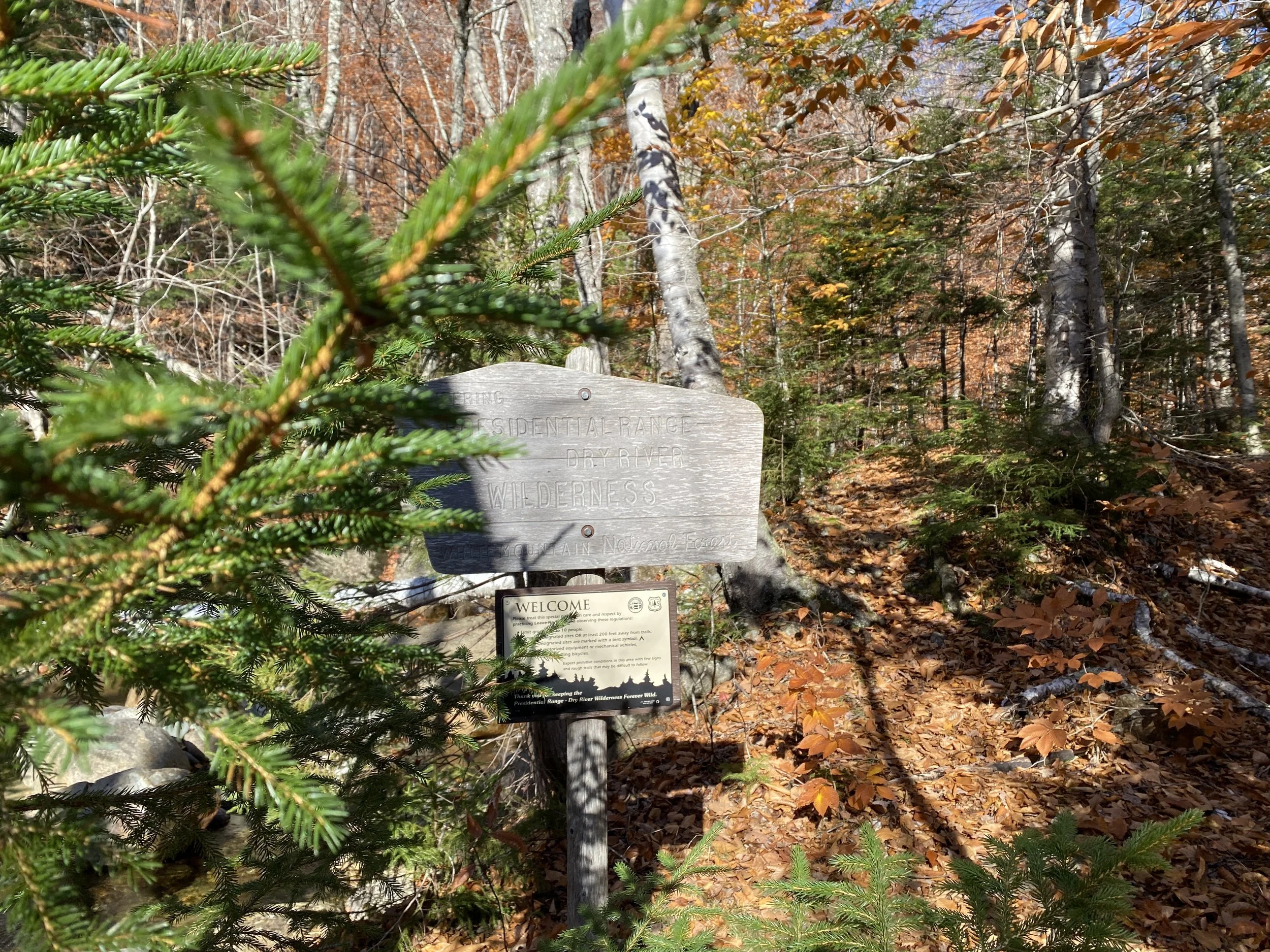
The Isolation Loop is a hike that will bring you deep into the Presidential Range-Dry River Wilderness. Starting and ending at the Davis Path trailhead, this hike gains around 6,400’ of elevation total, with the majority of that climbing happening on day one. We recommend completing this loop clockwise. Navigation along this route is in the moderate range. The Davis Path has been seeing much more traffic in recent years so navigation on this portion of trail shouldn’t be an issue, and Isolation Trail, East Branch is heavily trafficked, as is the northern portion of the Rocky Branch Trail. As you continue south on Rocky Branch Trail it will become more difficult to discern the footpath and same with on Stairs Col Trail, both of which are seldom used. Be sure to carry a map and know how to use it and as an added tool we recommend downloading Gaia GPS, a free navigation app that works without cell phone service.
The route is as follows:
Day One
10.5 Miles
4,300’ Elevation Gain
Davis Path -> Isolation Trail, East Branch, Tentsites are marked at the designated sites on Isolation Trail.
Day Two
12.5 Miles
2,100’ Elevation Gain
Isolation Trail, East Branch -> Rocky Branch Trail -> Stairs Col Trail -> Davis Path
Route Two
Sandwich Dome-Whiteface Traverse
Total Miles: 19.5
Elevation Gain: 6,200’
Navigation: 4/10
Elevation Per Mile: 7/10
Logistics: 8/10
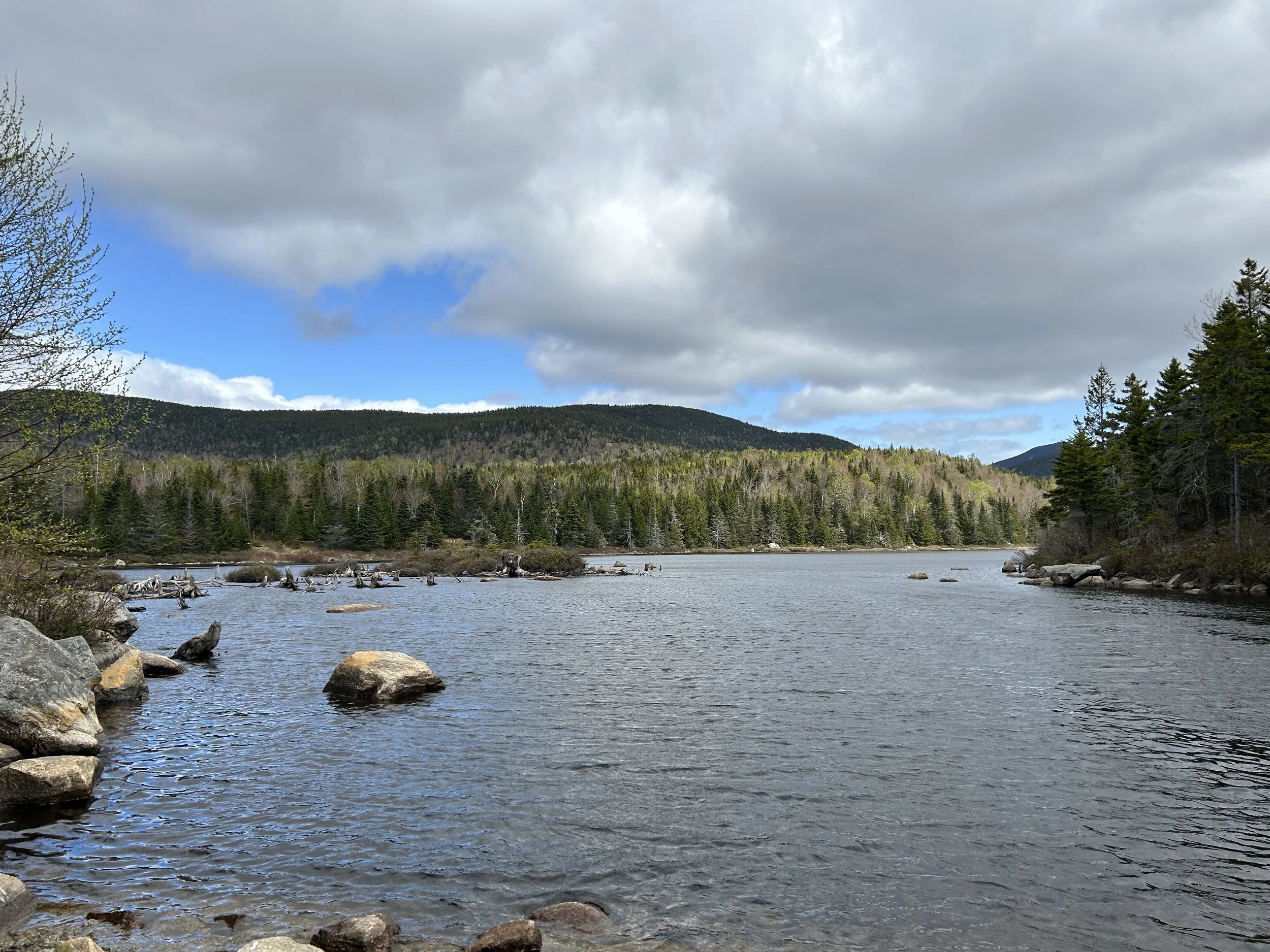
The Sandwich Dome-Whiteface Traverse is a route which traverses two mountains in the Wonalancet region of New Hampshire. Portions of this route are within the Sandwich Wilderness. Starting at the Algonquin Trailhead, you will ascend onto the ridge leading to the summit of Sandwich Dome before beginning the descent towards the Flat Mountain Pond Trail where you will spend the night. From here, you will continue along Flat Mountain Pond Trail to McGrillis Trail and the rocky viewpoint near the summit of Whiteface Mountain. The final stretch of trail is the most heavily trafficked, along Blueberry Ledge Trail, and then finally taking Blueberry Ledge Cutoff before reaching the trailhead at Ferncroft.
Both days are equally difficult, with almost equal amounts of climbing, however McGrillis Trail is, in our opinion, a more strenuous climb and offers little respite as it makes the ascent of Whiteface Mountain. Because this is a traverse hike, setting up transportation back to your car if you’re hiking solo makes it more logistically difficult. Navigation is overall not a problem on this hike, however do not underestimate the amount of time it will take to navigate Flat Mountain Pond Trail as it heads east towards McGrillis Trail. This stretch is less traveled and more cumbersome due to a smattering of boulders along the trail which runs parallel to a small ridge and the shores of Flat Mountain Pond.
The route is as follows:
Day One
9 Miles
3,200’ Elevation Gain
Algonquin Trail -> Bennett Street Trail -> Flat Mountain Pond Trail
Day Two
10.5 Miles
3,000’ Elevation Gain
Flat Mountain Pond Trail -> McGrillis Trail -> Blueberry Ledge Trail -> Blueberry Ledge Cutoff
Route Three
Three Ponds Loop
Total Miles: 5
Elevation Gain: 600’
Navigation: 4/10
Elevation Per Mile: 1/10
Logistics: 2/10
The Three Ponds Loop is an easy 5 mile loop hike that is not intended to be a strenuous hiking excursion, so much as an opportunity to sit in the woods for several hours and contemplate life, or love, or read a book. This loop starts and ends at the Three Ponds Trailhead and can be completed either clockwise or counter. Both directions are comparable in terms of elevation gain. Three Ponds is a beautiful area nestled among a series of small ponds and marshes. The three sided shelter where you can spend the night is tucked 50 yards away from the main trail right near Three Ponds. From here, you have a series of spots where you can rest and take in the scenery, and if you so choose, continue to venture along Three Ponds Trail as it heads across a beaver dam on Sucker Brook. This portion of Three Ponds, found after the beaver dam crossing, is less traveled and much more difficult to navigate, so proceed with caution. After spending the night at the shelter, you will take Donkey Hill Cutoff to Mount Kineo Trail along a series of waterfalls, and return to the trailhead.
The route is as follows:
Day One
2.5 Miles
500’ Elevation Gain
Three Ponds Trail -> Three Ponds Shelter
Day Two
2.5 Miles
75’ Elevation Gain
Three Ponds Trail -> Donkey Hill Cutoff -> Mt. Kineo Trail -> Three Ponds Trail
