Our Favorite Overnight Hikes in the White Mountains: Part 2
The White Mountain National Forest encompasses almost 800,000 acres of land in New Hampshire and Maine. Within those almost 1 million acres of land are over 650 individually named trails that are just waiting to be explored by the outdoor enthusiast. This week, we are sharing some of our favorite overnight routes within the White Mountains of New Hampshire. These routes will range in difficulty from easy to hard. We will rank each route in three categories: navigation, elevation per mile, and logistics. Each hike will earn a score between 1 and 10, one being easiest and ten being hardest, in each category. Navigation encompasses the difficulty to navigate the trail and the skills needed to follow the trail. Elevation per mile is how steep the trail is overall and the physical difficulty of the hike for the average hiker. Logistics includes whether or not the hike requires booking things ahead of time or if it would require a carspot for a solo hiker.
Furthermore, we will give general information about each route including miles, overall elevation gain, and a summary of the terrain you will encounter, as well as camping options. We encourage everyone who sets out on a hike in the White Mountains of New Hampshire to purchase a copy of the White Mountain Guide and map set and study the route before setting out. Follow Leave No Trace Principles, camp only in designated spots, and bring the Ten Essentials (at minimum). Let someone at home know your planned itinerary and check the weather at the trailhead as well as on the summit (when applicable) the day you intend on setting out.
Route One
Carrigain Loop
Total Miles: 15 Miles
Elevation Gain: 4,300’
Navigation: 8/10
Elevation Per Mile: 5/10
Logistics: 2/10
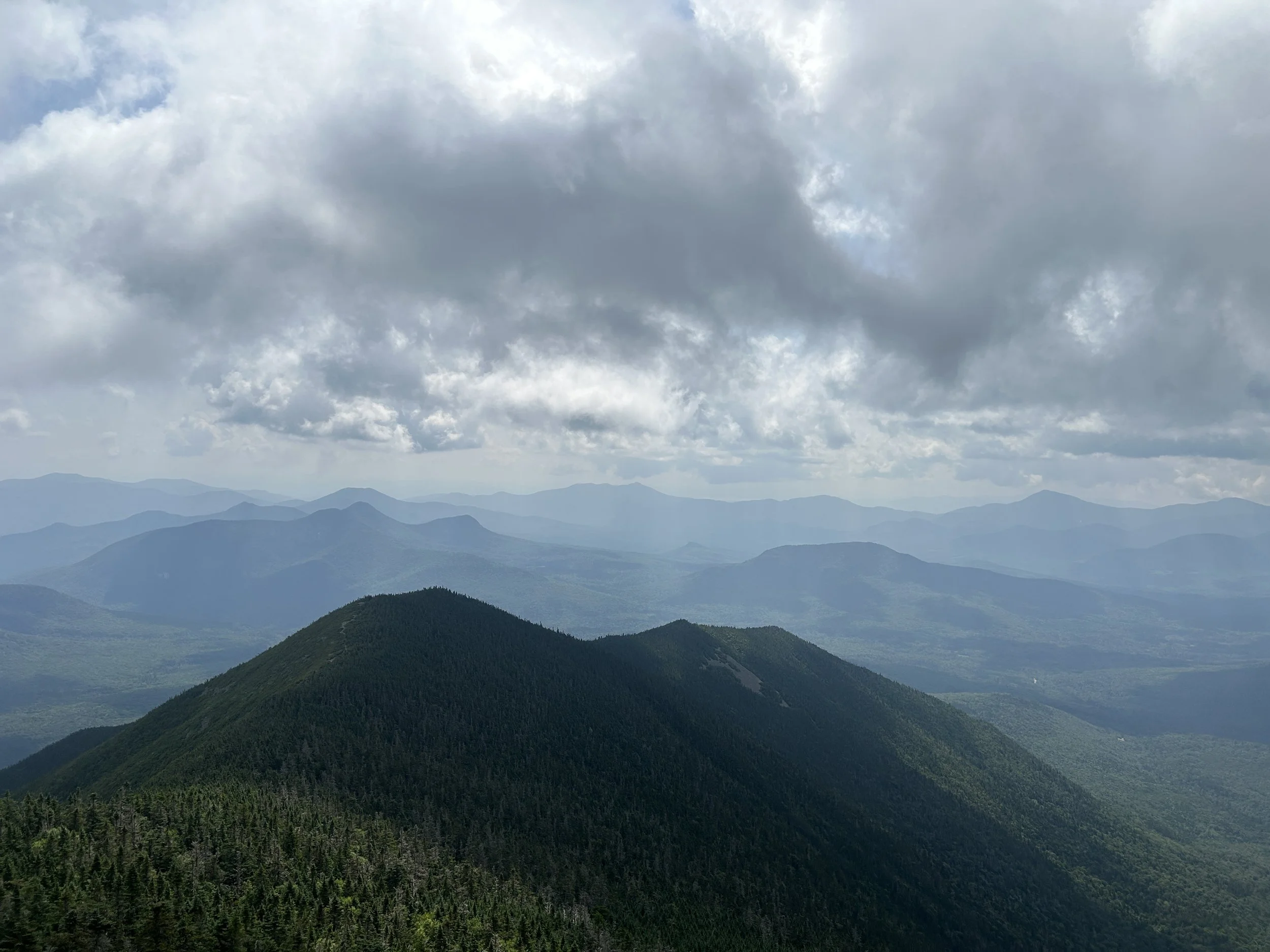
This loop hike takes you directly over the summit of Mount Carrigain, before descending the steep Desolation Trail located within the Pemigewasset Wilderness and finally culminating at Stillwater Junction where you can spend the night. Bear in mind that Stillwater Junction is not an official campsite, so do not create fire rings or start fires. From the start, this hike is on well traveled trails leading to the summit of Mount Carrigain. The climb is pretty consistent, and offers little respite along the way. The word relentless comes to mind when thinking about this ascent. From the summit, where there is a beautiful view from the observation deck, you make your descent down the back side of the mountain, entering the Pemigewasset Wilderness. Desolation Trail is rocky and steep at times, but navigable and easy to follow. After making the descent, you continue towards Stillwater Junction along Carrigain Notch Trail.
The following day, you will retrace your steps back along Carrigain Notch Trail, and continue past the junction with Desolation Trail. From here, the trail gets a bit less traveled and although we didn’t encounter any difficulty with following the trail through Carrigain Notch, we want to reiterate that this section of the loop is less traveled. Carrigain Notch Trail runs through the notch between Mount Carrigain and a few smaller peaks, gradually climbing less than 800’ in two miles to the height of land before descending towards the junction with Signal Ridge Trail, which you will take back to the trailhead.
The route is as follows:
Day One
Miles 7.5
Elevation Gain 3,400’
Signal Ridge Trail -> Desolation Trail -> Carrigain Notch Trail
Day Two
Miles 7.5
Elevation Gain 900’
Carrigain Notch Trail -> Signal Ridge Trail
Route Two
Mill Brook Loop
Total Miles: 12 Miles
Elevation Gain: 2,100’
Navigation: 2/10
Elevation Per Mile: 2/10
Logistics: 2/10
The Mill Brook loop hike is a shorter route that doesn’t culminate on any summits, but offers two separate spots for spending the night. We chose to end day one at the Roger’s Ledge Campsite rather than the Unknown Pond Campsite because Roger’s Ledge is less busy. This hike also requires a roadwalk back to your car along York Pond Road if you’re not using a carspot. The roadwalk is around 2 miles long and flat.
The route starts on the less traveled Mill Brook Trail which makes a gradual ascent from York Pond Road. The trailhead is tucked back behind one of the buildings on this road (which is home to a fish hatchery). This is a shorter hike, less than 4 miles, to the Roger’s Ledge Campsite. Roger’s Ledge Campsite is a beautiful site to spend the night, nestled on a side trail off of Kilkenny Ridge Trail.
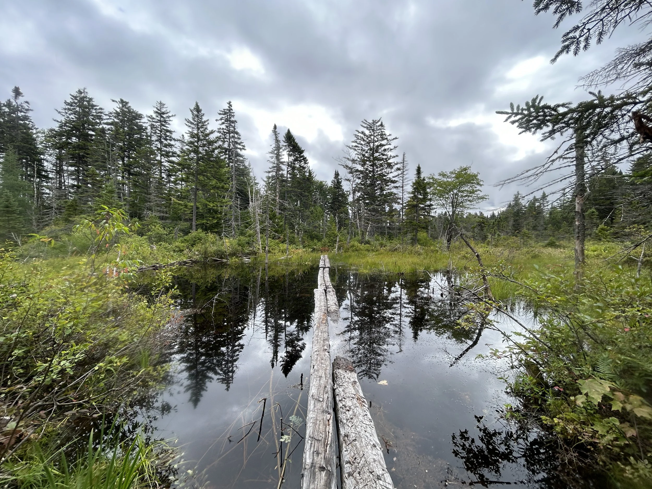
Day two runs along Kilkenny Ridge Trail heading towards Unknown Pond. You will be making a short ascent, roughly 1,000’, in 2.5 miles. From the junction with the Unknown Pond Trail, you bank left and head back downhill to York Pond Road. Unknown Pond is a beautiful spot to take a break next to a quiet small body of water. Upon reaching the trailhead, you will have a 2 mile road walk back to the start of your hike. This is a dirt road that runs through a fish hatchery.
The route is as follows:
Day One
Miles 3.75
Elevation Gain 1,100’
Mill Brook Trail -> Kilkenny Ridge Trail -> Rogers Ledge Campsite
Day Two
Miles 7.5
Elevation Gain 1,000’
Rogers Ledge Campsite -> Kilkenny Ridge Trail -> Unknown Pond Trail -> York Pond Road
Route Three
Appalachian Trail Traverse
Total Miles: 7
Elevation Gain: 2,500’
Navigation: 2/10
Elevation Per Mile: 5/10
Logistics: 8/10
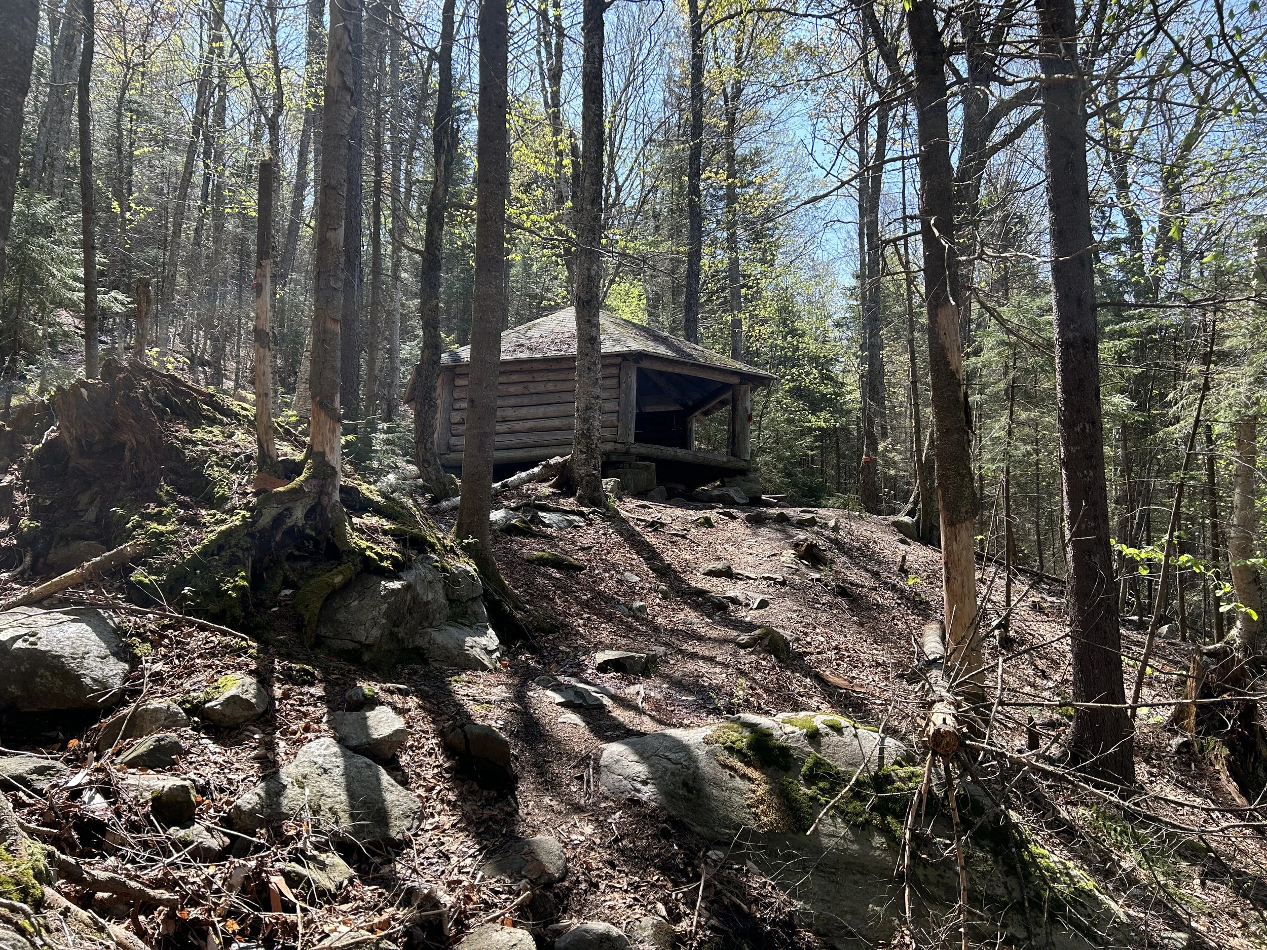
This is a short traverse hike that runs over the summit of Mount Cube (which is a really popular summit) along the Appalachian Trail, and ends at one of the most beautiful shelters, the Hexacuba Shelter. The second day we ended early, after only 2 miles of hiking, at the Quinttown Road AT parking lot. There is the option to continue along on the Appalachian Trail day two, making for a long hike, getting off trail at any of the junctions (Lambert Ridge Trailhead, Dorchester Road, etc). This traverse has two main features that is what led us to choose it for our final overnight favorite in the White Mountains: Mount Cube and the Hexacuba Shelter. This shelter is shaped like a hexagon with one open side. Bear in mind that because this shelter is along the AT, it could be crowded depending on what time of year you’re hiking it (summer will be peak for thru-hiker season).
The route is as follows:
Day One
Miles 5
Elevation Gain 2,300’
Mount Cube Trail -> Hexacuba Shelter
Day Two
Miles 2
Elevation Gain 200’
Hexacuba Shelter -> Kodak Trail -> Quinttown Road
What are some of your favorite overnight hikes? Comment below!